by Anne Evans
What this Blog is not: The ultimate guide to beach combing.
What this Blog is: The ultimate encouragement to be adventurous.
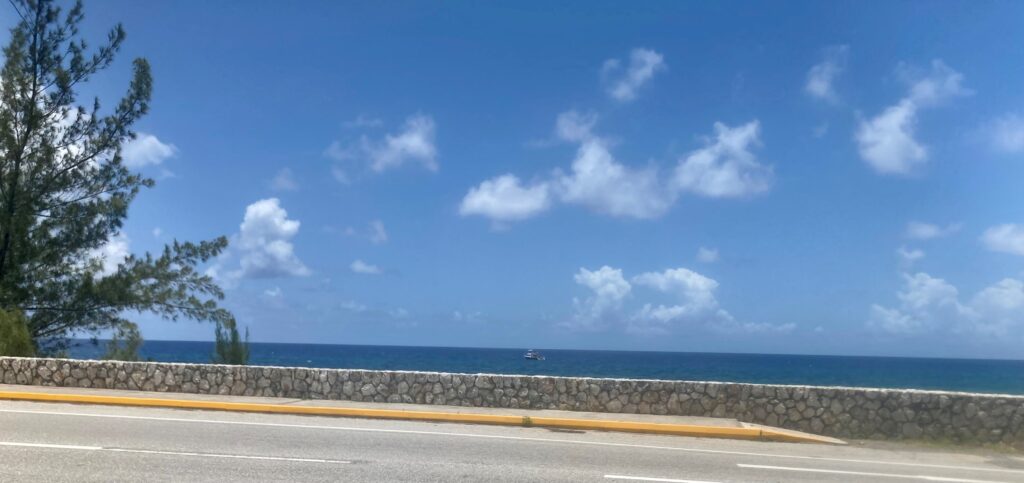
Grand Cayman is surrounded by 99 miles (160 km) of coastline – some with white sand as soft as silk; others rocky and still others composed of ironshore, the latter being jagged, spongy pinnacles of black-covered limestone in the “Hell” area of the island.
All beaches in the Cayman Islands are public. However, there are places where uninterrupted stretches of private property between roads and the beach can make access challenging. There are no lifeguards on duty.
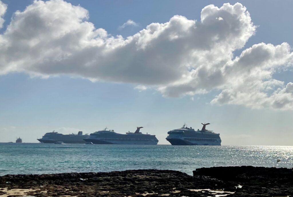
Cruise ships generally anchor off the capital, George Town, and tenders are taken to shore. The ships are only in port for the day.
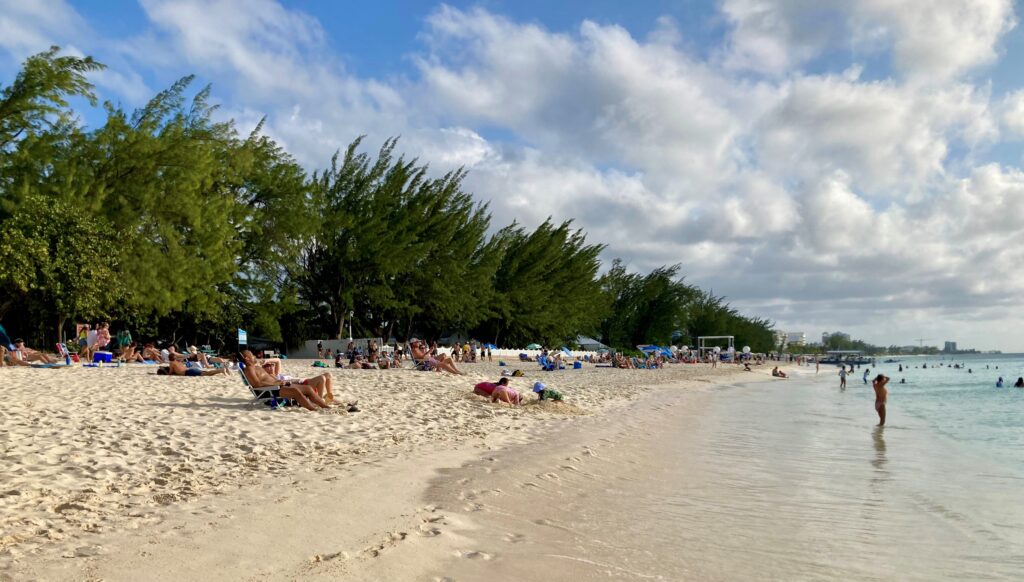
Seven Mile Beach
When we first announced our intent to move to Grand Cayman to an acquaintance, an avid cruiser with a tendency to “one up” any experience one might have to offer, her response was to state that 7-Mile Beach was not really 7 miles long. Yes, I know; however, please, do you really need to rain on my parade? I said quietly to myself while smiling outwardly.Of course, she is even more correct now, given beach erosion – a bit more on that later.
As Honolulu has its famous Waikiki Beach, Grand Cayman is seemingly synonymous with 7-Mile Beach, however there is so much more. And yet, I would venture to say that most of the Cruise Ship “Day Trippers” see little else.
Indeed, it is an amazing set of beaches that stretch north and south along the west coast of Grand Cayman and just minutes by foot from our home. These beaches reach out in front of luxury condominiums and resorts such as The Ritz, The Westin, and the Kimpton, and include local favorites such as Governor’s, Public, Cemetery and West Bay Beaches. As noted above, all beaches in the Cayman Islands are public, including the water and sand in front of the hotels and condominiums; just not the chairs and umbrellas set out in front of those buildings for their residents and visitors!
The sand is the softest I have ever experienced with typically warm, calm waters that offer barely a hint of a wave. My first swim was an unbelievable experience. With just swimmers’ goggles, I glided along and watched the fish swim beneath me. The water was so clear I could see tiny ripples in the sand. Having grown up among the crashing waves and murky waters of the California Pacific Ocean, this contrast is astounding. It’s no wonder that it is the and most popular – and crowded – beach area on the Island.
Lesser-Known Beaches
More white-sand beaches out of the tourist areas include Spotts Beach, Rum Point and East End/Colliers Beach. You need a vehicle to reach them, so they are not generally cruise passenger destinations. Here, you are likely to find stay-over visitors, especially those returning to the Island, as well as locals.
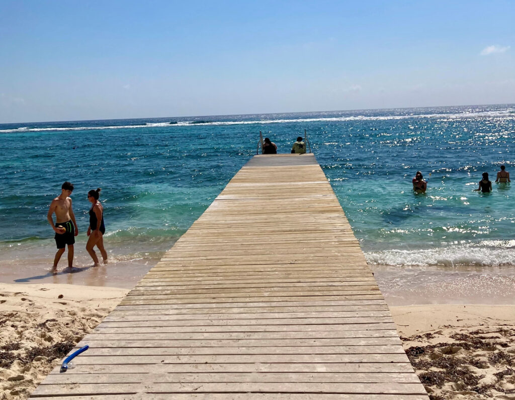
Spotts lies east from George Town on the South Sound and on rare occasion is used as an alternate site for Cruise ships to drop anchor when sea conditions are too rough at George Town. I’s a nice little beach with a small parking lot, port-a-potty and a couple of picnic tables.
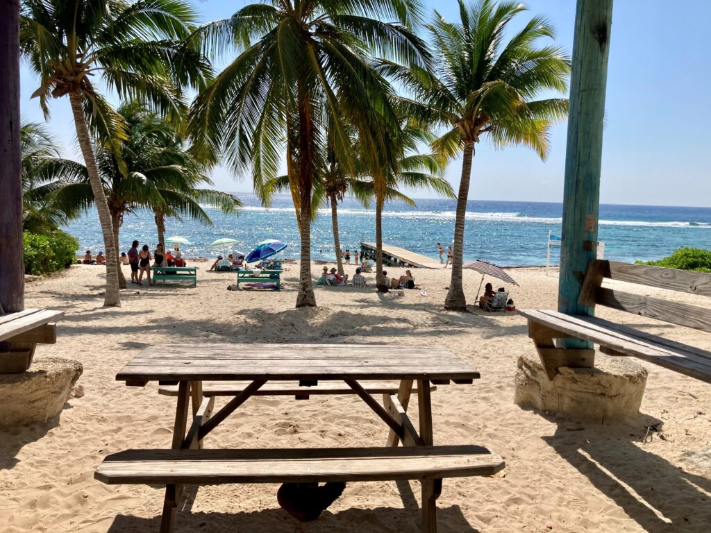
The water is generally tranquil and clear. When Rick and I last visited on a weekday “in season”, there was quite a gathering of folks lounging or picnicking on the beach with a few in the water, some snorkeling and a couple sitting peacefully at the end of the pier.
Rum Point boasts a collection of beaches of varying nature, all somewhat isolated at the north end of the Island. It’s at minimum a day trip, if not serving as your home base for the duration of your stay on Grand Cayman. From George Town by car, it is roughly a 45-minute drive each way if you avoid peak weekday traffic times and weekends. If you choose to drive during peak traffic, anticipate 2+ hours each direction.
It is an interesting adventure to drive there – initially along the South Sound, then cutting north across the Island at the boundary between North and East End and finally turning west to drive along the shore of the northern Caribbean Sea to your destination. There is a ferry which runs between Camana Bay and Rum Point in Season – a lovely 30-minute ride each way across the North Sound. Ideally, one would be of (seriously) Independent Means and sail your private yacht across the North Sound to dock at your Villa on Rum Point. Were that my option, I would be living there. To understand why, read about my first visit to Rum Point.
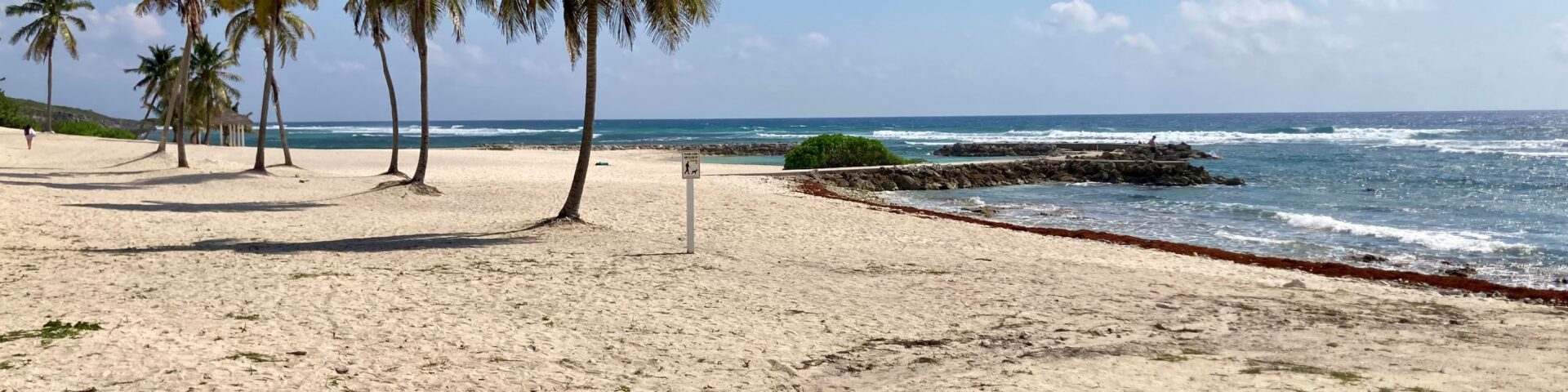
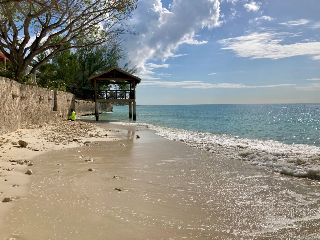
East End Beach, also known as Collier’s, is located at the far east end of the Island, not far from the Wyndam and Morritt’s Resorts. The East End is considerably less developed than Grand Cayman’s Western Side, and unless you are perhaps a fit and adventurous cyclist, you will need a car to reach it from George Town. Yes, you could take a bus from George Town, however I wouldn’t advise it as it can be challenging to find one to return. (See East End – Google Maps.) Typically, this wide beach is calm with shallow waters, although on windy days, East End Beach attracts kite or wind surfers. It offers shaded picnic tables, a restroom facility, a short dock, and parking on the sand under shade trees. It is definitely worth the effort to visit for beachgoers that prefer seclusion.
Little Known Treasures
As you might have guessed, my preference for beaches (and places in general) is for the little know treasures – the places that don’t pop to the top of a google search, if they appear on it at all. They are the places at the end of that unmarked road on your map – or maybe you find that the road doesn’t really end at all but instead just keeps getting narrower and becomes a dirt trail until you realize you have driven full circle around the Island (been there; done that; Maui, HI circa 1974)!
The following is a map that invites such adventures on Grand Cayman: Testudo’s Snorkel Guides – Google My Maps
Expand the map and look closely at the coastline. As you drive along the South Sound from the southwest of the Island to East End the surface streets dwindle although among them are those lanes where a right turn will lead you to a beach that no one told you about.

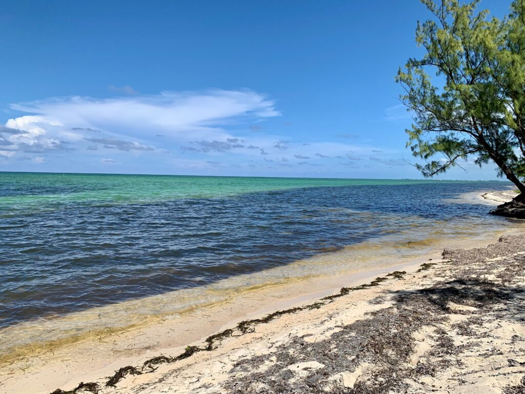
Continue on, you will be driving along Seaview Road with great expanses of the Caribbean Sea to your right as well as scattered homes and small businesses along the way. Patches of white sand, interspersed with rocks and white capped waves, and areas of vegetation that come up to the shoreline parallel the road.
As Seaview Road reaches the far east of East End, it turns north and continues along the shore. At the far north end just past the Wyndam and Morritt’s Resorts, it becomes Queens Highway, which as you head west on the “North Side” ultimately becomes Rum Point Drive. The latter ends at (where else but) Rum Point. Stop anywhere you like on this sparsely populated route and savory the beauty of the Caribbean Sea.
To continue a circumferential drive of Grand Cayman’s coastline, you would head on to Barker’s National Park – however you cannot. The North Sound is in the way.
No-go. Instead, drive back to George Town and then north through West Bay as far as you can before turning east.
Barker’s National Park is located at the most northeastern part of West End on Grand Cayman. This is one of the least developed areas of Grand Cayman.
Unfortunately, despite its name, Barker’s is not actually a National Park. Most of the land is in private ownership. This is why there is no “park” maintenance nor amenities or facilities. Indeed, what Rick and I experienced during our first visit included bouncing along somewhat paved, sometimes flooded roadways in our car. However, when we parked by the side of the road and walked a short dirt path or through some brush towards the water, we would discover stretches of secluded beach showcasing the AMAZING pristine emerald green and turquoise blue sea. The land between the road and the beach may have been privately owned, however remember: all beaches in the Cayman Islands are public.
Threats to the Coastline
The amazing beauty of Grand Cayman’s coastline is threatened today by problems that have become significant over the last decade, both attributed to climate change.
Sargassum
Sargassum is a free-floating brown macroalgae (seaweed) from the North Atlantic that suddenly appeared in large quantities in the tropics in 2011. Massive bloom of seaweed in tropical Atlantic raises the risk for Caribbean, Gulf, and Florida beach impacts in coming months | NOAA Climate.gov Today, it threatens shores and waters of the Caribbean, Gulf of Mexico, and around Florida – particularly during the spring and summer months.
Sargassum tends to affect the windward side of each of The Cayman Islands and will inundate those beaches. On Grand Cayman, historically the most protected areas are the west facing beaches (Seven Mile Beach), and the most impacted are the east (East End) and then south (South Sound) facing areas. However, in one of the more recent surges (March, 2023), Sargassum entered the Island’s North Sound, choking areas of its shore line. It even made its way into the canal my home boarders on – located halfway between the North Sound and Seven Mile Beach. At present, there is no uniform interventional response developed for addressing future, largescale invasions of sargassum in The Cayman Islands. But various agencies are working on a national response to sargassum.
Beach Erosion
Areas of the 7 Mile Beach that 5 years ago were confluent are now broken by water.
Some resorts and condominiums have entirely lost their beach. One example is The Grand Cayman Marriott ‘Beach’ Resort, which was forced to drop “Beach” from its name as the waves of the Caribbean sea now lap at its sea wall.

The evidence of beach erosion surrounds Grand Cayman and there are no longer deniers. (See statistics on beach erosion on grand cayman – Google Search.) However little action has been taken to prevent its progression. (The Disappearing Beach: Coastal Boundary Line is in the Water. Nov 28, 2023 and Government Action Needed on Beach Erosion. Jan12, 2023.)
The effects of climate change on Grand Cayman empart a sharp-edged meaning to the phrase “live in the present,” because that white sand beach at your door step may be gone with the next sunrise or at best choked with sargassum. But the phrase “plan for the future” strikes fear into my heart that we have not, and that it may be too late.

Get The Expatriate Baker’s Free Recipe Book
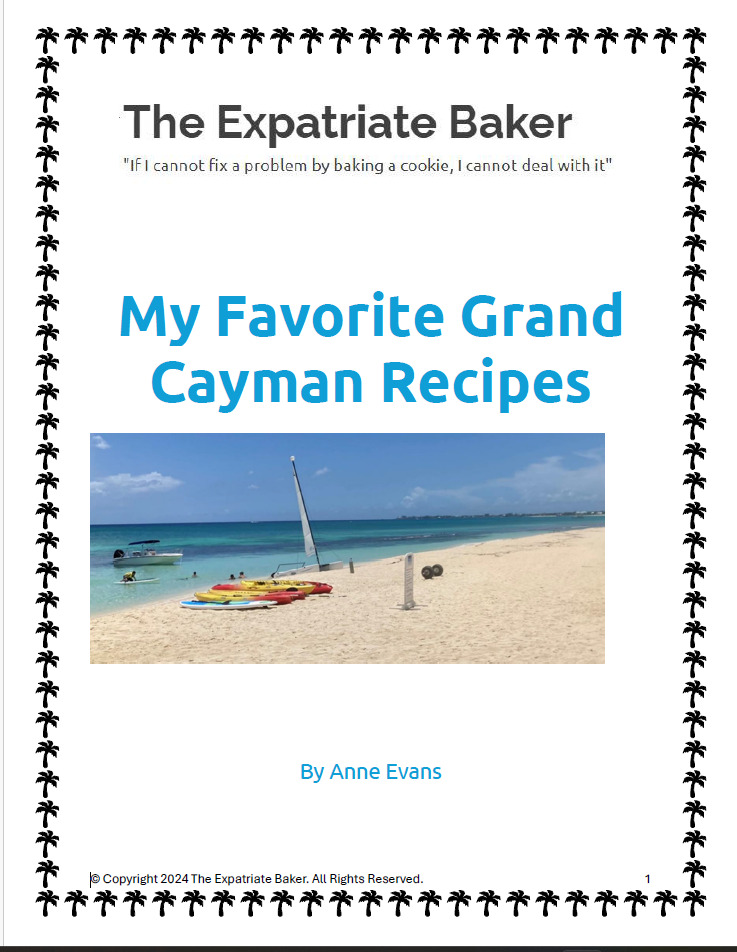
The secrets of favorite desserts but with a Cayman Islands flair! This 18-page PDF takes you from brownies to shortbread (shared on the Martha Stewart show) to a decadent white chocolate vanilla cognac mousse. Even some savory dishes and breads are included. Request your copy, and we’ll send you a link.
The secrets of some of my favorite desserts but with a Cayman Islands flair! This 31-page PDF takes you from brownies to shortbread (shared on the Martha Stewart show) to a decadent white chocolate vanilla cognac mousse. Even some savory dishes and breads are included, plus holiday egg nog and rum ball favorites. Request your copy, and we'll send you a link.
One comment